Motto
Heal the Land.
Feed the People.
Protect the Future.

Environmental Intelligence + Agriculture Intelligence
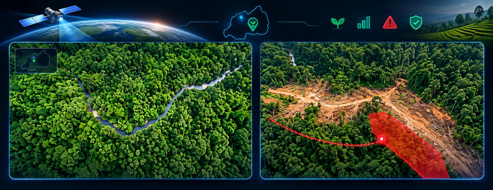
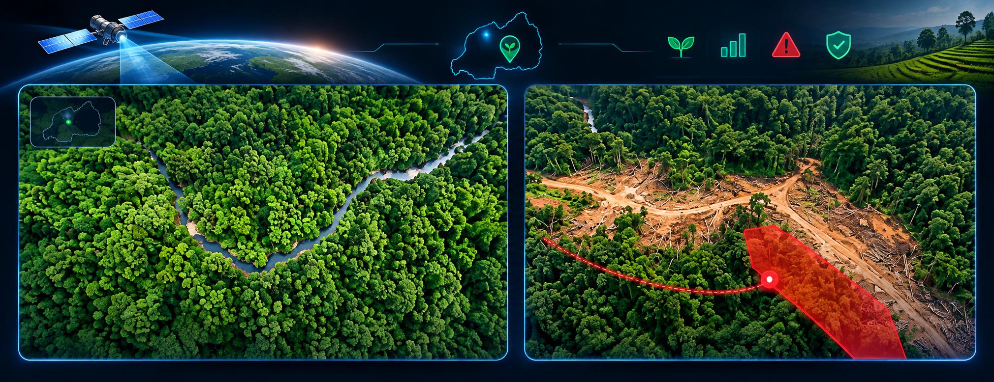
Continuous 24/7 optical and SAR radar surveillance penetrating dense cloud cover and darkness to catch illegal deforestation in real-time.
Heliocentric System Group is a purpose-driven deep-tech company at the intersection of precision agriculture and environmental sustainability. Through our platforms, we turn data into action—and action into lasting impact.
Climavise delivers environmental intelligence: satellite radar, AI, IoT sensors, and drone verification that help communities and conservation authorities protect forests, wetlands, rivers, lakes, and marine ecosystems.
Eza Climavise delivers agriculture intelligence: AI-powered crop diagnostics, agro-input support, and drone field mapping that empower farmers to protect their harvests—accessible via smartphone, the SAROK handheld device, and Drone-as-a-Service.
Moise Iradukunda, our founder, grew up in a rural village in Rwanda where farming was the only livelihood. Season after season, his family watched their crops destroyed by undetected pests and diseases, with no tools, no guidance, and no support. The result was hunger, financial hardship, and broken dreams.
In May 2018, a devastating landslide struck his hometown in Western Rwanda, claiming 18 lives and displacing hundreds of families. The disaster, worsened by severe deforestation and unsustainable land use, became a defining turning point.
Still a secondary school student, Moise committed himself to building solutions. Incubated at the African Centre of Excellence in Data Science, University of Rwanda, that vision grew into Climavise for environmental protection and Eza Climavise for precision agriculture—recognized by the International Astronautical Federation and selected for presentation at GLOC 2026.
Motto
Feed the People.
Protect the Future.
Vision
A future where every farmer has access to intelligent tools, every forest is protected, ecosystems flourish, and environmental threats are addressed before lasting damage occurs.
Mission
To deliver accessible AI-powered solutions for sustainable agriculture and to safeguard vital ecosystems by connecting satellite, sensor, and drone intelligence with verified on-the-ground action.
We build AI-powered platforms that solve two of the world's most urgent challenges: food insecurity and environmental degradation. Our solutions are designed to be accessible, affordable, and impactful for farmers and conservation teams alike.
An AI-powered crop diagnostics platform that identifies diseases, pests, and nutrient deficiencies in as little as 1.8 seconds. Available via smartphone app, the SAROK handheld device for non-smartphone users, and a Drone-as-a-Service solution for large farms and cooperatives.
A near real-time environmental monitoring system combining satellite radar, smart sensors, AI anomaly detection, and drone verification to detect illegal land-use changes and deliver timely, verified alerts to decision-makers—even in the most remote areas.
From early warning to verified enforcement and long-term ecosystem recovery
Continuous 24/7 all-weather optical & SAR satellite monitoring with AI anomaly detection across forests, wetlands, and water bodies.
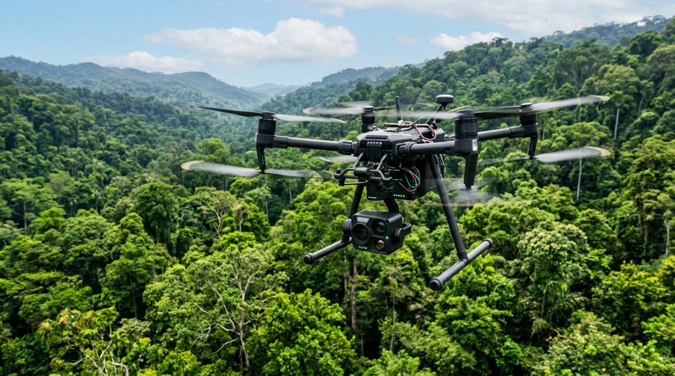
Acoustic IoT cross-checking and drone visual verification dispatch to exact GPS coordinates before threats cause irreversible loss.
Transparent spatial analytics and degradation history empowering authorities and communities to target ecosystem recovery efforts.
Safeguarding natural capital, water security, and sustainable livelihoods for vulnerable communities that depend on healthy ecosystems.
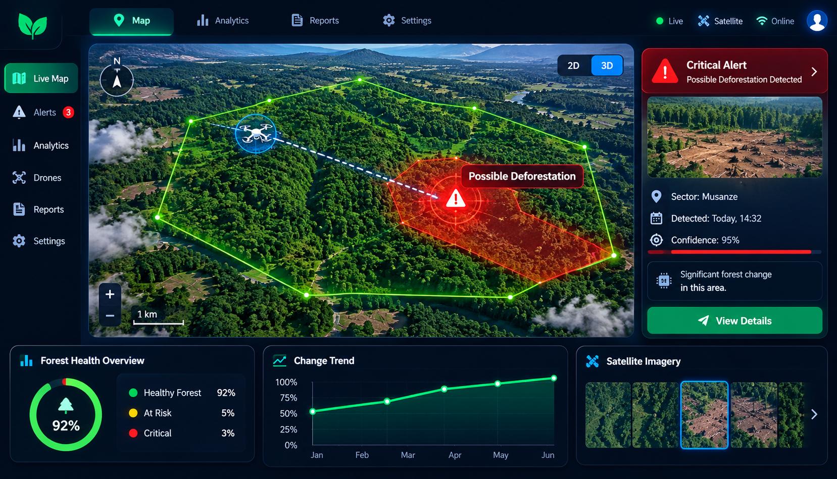
Climavise unifies space, aerial, and ground data streams into an actionable decision-support pipeline.
 24/7 All-Weather
Continuous fusion of Sentinel-1, Sentinel-2, Landsat 8/9, and SAR radar imagery. Operates day and night through dense clouds and heavy weather, directly addressing the reality that 60% of illegal degradation occurs in the dark.
 Deep Learning
Deep learning U-Net CNN architectures combined with Z-score NDVI/EVI anomaly algorithms flag micro-changes in canopy cover, unauthorized clearing, and environmental degradation faster with minimal false negatives.
 Persistent Ground Mesh
Low-power sensor networks deployed across remote terrestrial and aquatic habitats capturing acoustic signatures (chainsaws, gunshots, vehicles), seismic vibrations, temperature shifts, and water quality anomalies.
Rapid ConfirmationAutomated dispatch of 4K UAV inspection to satellite-flagged anomaly coordinates before alerts are escalated to law enforcement. Dramatically reduces false positives and delivers legal-grade evidence for rapid response.
Biodiversity SafeguardBaseline movement mapping and real-time boundary breach monitoring for wildlife in national parks and reserves. Protects vulnerable species from poachers and prevents human-wildlife conflict in nearby communities.
 Actionable Intelligence
Interactive geospatial intelligence dashboard that delivers prioritized, geolocated coordinates, risk heatmaps, case lifecycle tracking, and instant notifications directly to rangers and conservation authorities.
Comparing untouched baseline terrain with today's live satellite capture
Endorsed by the International Astronautical Federation and selected for presentation at the Global Space Conference on Climate Change, Climavise is designed for real operational enforcement across forests, wetlands, lakes, and marine ecosystems.
Comprehensive services spanning precision agriculture with Eza Climavise and environmental intelligence with Climavise.
 Eza Climavise
Instant, accurate, and offline-capable crop disease, pest, and nutrient deficiency detection.
 Eza Climavise
From diagnosis to treatment, end-to-end agro-input ordering and delivery for farmers.
Eza ClimaviseField health mapping for large farms and cooperatives with actionable crop insights.
ClimaviseContinuous optical and SAR radar monitoring through clouds and darkness to detect illegal logging and land clearing.
ClimaviseAutonomous 4K UAV dispatch to satellite-flagged coordinates to verify incidents, slash false positives, and gather evidence.
ClimaviseGround and aquatic sensors detecting real-time sounds of chainsaws, gunshots, vehicles, and seismic vibrations in remote areas.
ClimaviseBaseline movement mapping and boundary breach detection to protect vulnerable species and mitigate human-wildlife conflict.
Both PlatformsData-driven insights and geospatial command interfaces for governments, development partners, and conservation authorities.
Eza ClimaviseHuman support when technology needs a human touch—extension services for farmers adopting AI tools.

CEO & Co-Founder
Drives strategy, partnerships, and execution with a background in data science and business development.

Full-Stack Software Engineer
Leads all technical development, from AI model integration to mobile app and dashboard architecture.

Agricultural Specialist, Horticulture
Ensures every diagnostic and recommendation is grounded in real agronomic expertise and on-farm practicality.

AI & Data Science Engineer
Leads model development and space data integration, specialized in machine learning, and serves in geospatial data processing and analysis.
Climavise and Eza Climavise are built by a small, passionate team with big ambitions and limited resources. Every contribution, large or small, helps us reach more farmers, improve our technology, and protect more land. We are a registered innovation project incubated at the University of Rwanda, validated in the field, and ready to scale. Your support makes that possible.
100% of donations go directly toward technology development, field pilots, farmer onboarding, and conservation deployment.
Get in touch with our team
info@heliocentricsystem.com
Location
Kigali, Rwanda
Incubated at
African Centre of Excellence in Data Science, University of Rwanda